be one of the first

Find your next paddle.

Real routes, not just pins. The launch, the get-out, the portages and the hazards, with the wind, tide and river context for the day you're actually going.

Paddle Routes is brand new. Be one of the first to join the paddlers mapping the UK's canals, rivers and coast.
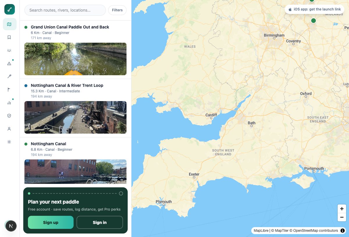
free on the App Store · or in any browser
on the web
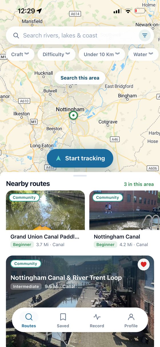
Finding a route on iOS: the map with nearby routes listed underneath.
on iOS
contributors

Add the routes you know. Get Pro for free.

Paddle Routes is mapped by the people who paddle it. Publish 3 routes that pass review, like the local canal or the loop you know by heart, and we'll add a month of Pro to your account: live conditions, offline maps, analytics, the lot.

every 3 approved routes earns another month · no cap, no expiry
PPete JenkinsFREECONTRIBUTOR
2 OF 3 APPROVED THIS CYCLE
Nottingham Canalcanal · 6.8 km · approved 3 Aug
Grand Union Canal Paddle Out and Backcanal · 6 km · approved 9 Aug
+Add one more routeunlocks Pro
counts your approved routes all-time1 more → a month of Pro
routes

Know the route before you launch

Move the map, see what's near you, and open a route to the things that actually decide the day: where to launch, where to get out, where to park, and what's in the way.

Distance, estimated time, route type and which craft it suits. Portages, hazards, escape points and step-by-step directions where the contributor recorded them, with their photographs from the water and what they made of it.

Find a route
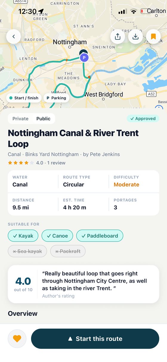
A route's detail screen: the line on the map, parking and start markers, then distance, estimated time, portages, which craft it suits, and a paddler's review.
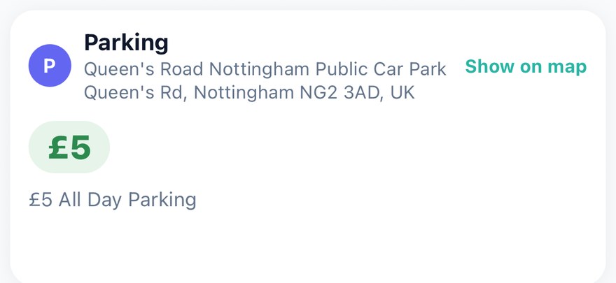
A route's parking card: Queen's Road Nottingham Public Car Park, its address, and £5 all day parking.
Parking, with the price
Where to leave the car, the postcode, and what a day costs.
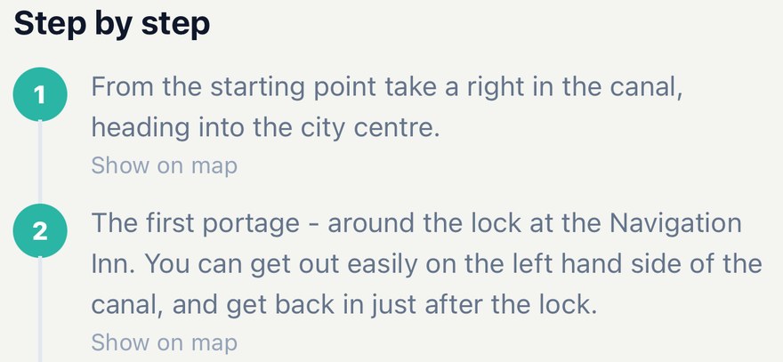
Numbered step-by-step directions for a route, describing which way to turn out of the start and how to portage around the first lock.
Step by step
Directions written by the person who actually paddled it.
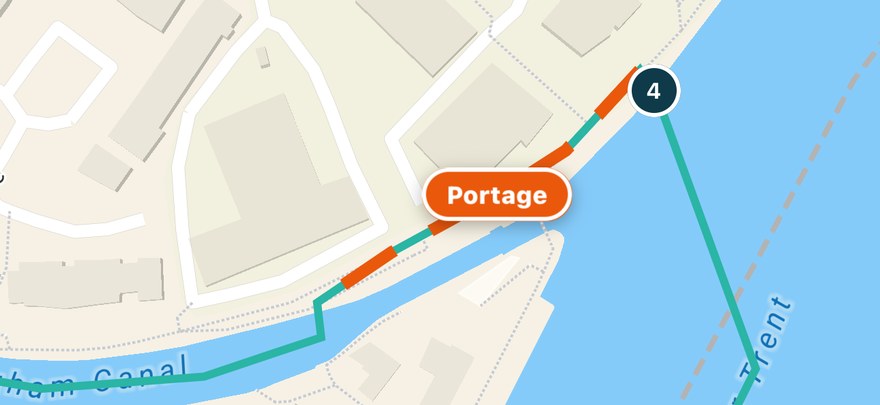
A close-up of the route map with a portage drawn as an orange dashed line along the bank, labelled Portage, between the canal and the river.
Portages on the map
Where to get out, carry, and put back in.
conditions

A forecast that knows which way you're going

Wind read against the direction you're actually paddling: headwind, tailwind, crosswind and quartering, section by section, with the return leg worked out separately. So an easy paddle out doesn't become an hour of grinding home.

Tides against your timings, river gauges against the range the route's contributor recorded as runnable, and flood alerts for the stretch you're on. Coverage varies by area and provider, and it's shown on the card.

How conditions work
DATA SOURCES
Open-Meteo forecastWorldTidesEnvironment Agency gauges & flood alerts
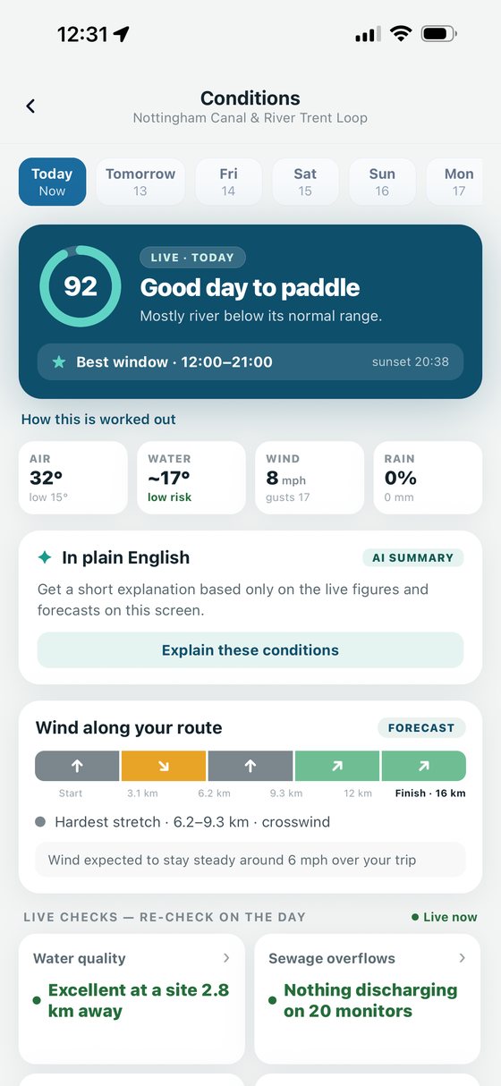
The conditions screen for a route: a score for the day, wind along each section of the route, and live water checks.
The calmest-looking water is often the most dangerous.

An offshore wind flattens the water and pushes you away from shore. Easy paddling out, much harder coming back. It's the one most forecasts bury, and it's the reason wind is read against your route's direction here.

SOURCE
RNLI lifeboat launch statistics, 2024
conditions in depth

See what the water is doing

Every check on the conditions screen opens in full: what the number is, where it was measured, how recently, and what it doesn't tell you. Live readings, annual classifications and modelled outlooks are kept visibly separate, because they are not the same thing.

Coverage varies by area and provider, and a missing source is shown as missing rather than quietly read as an all-clear.
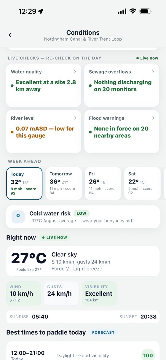
The conditions screen scrolled down: live checks for water quality, sewage, river level and flood warnings, a week-ahead row, cold-water risk, and current weather.
The day at a glance
Live checks, the week ahead, cold-water context and the best window.
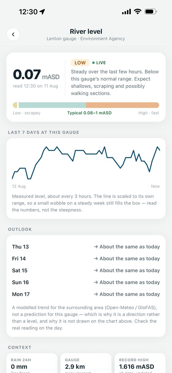
A river level screen: a live Environment Agency gauge reading against its typical range, seven days of measured level, and a modelled outlook shown as a direction rather than a level.
River level
The live gauge against its typical range, with seven days behind it.
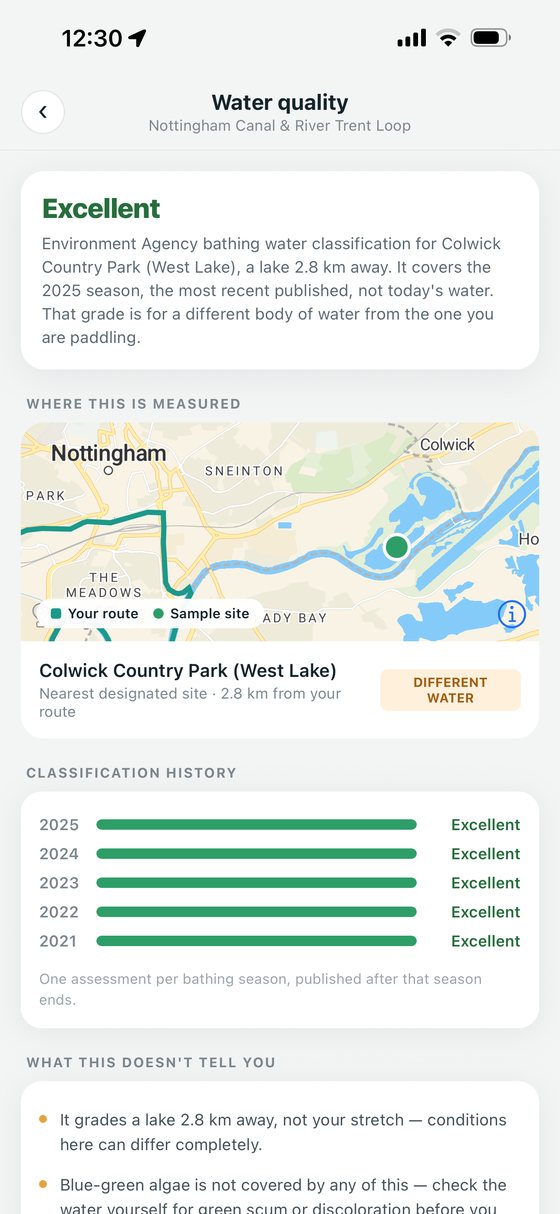
A water quality screen: an Environment Agency bathing water classification, where it was sampled, five years of history, and a note that it grades a different body of water.
Water quality
The nearest designated site, its history, and what it does not cover.
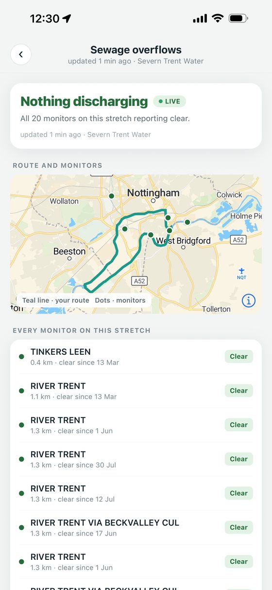
A sewage overflow screen: nothing discharging across twenty monitors, mapped against the route, then every monitor listed with its distance and how long it has been clear.
Sewage overflows
Every monitored overflow on the stretch, and how long it has been clear.
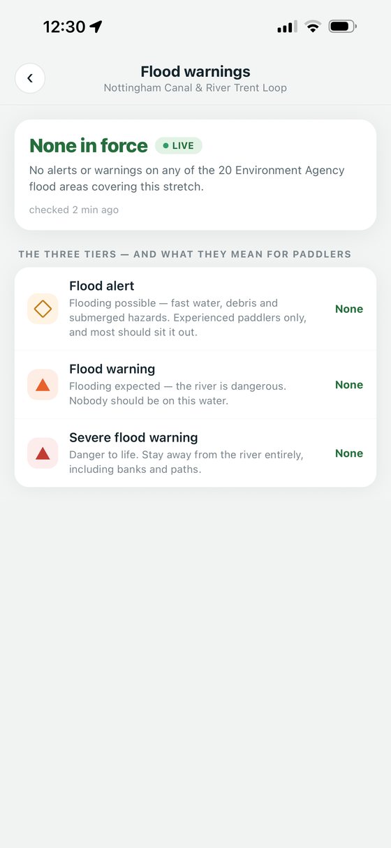
A flood warnings screen: none in force across the twenty Environment Agency flood areas covering the route, and what a flood alert, flood warning and severe flood warning each mean.
Flood warnings
What is in force now, and what each tier means for a paddler.
safety

The safety features are free. All of them.

Three tools that take a minute before you launch, and one screen you hope never to open. Paddle Routes helps you prepare and tell people what you are doing. It is not a monitored emergency service.
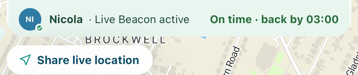
Live Beacon
from the recording screen
The Live Beacon bar across the top of the recording screen: the contact holding the link, that the Beacon is active, the expected return time, and a Share live location button.

Share a link before you launch and whoever holds it sees your latest reported position and how long ago it updated, in any browser. No account, no app install, and it stops working when the session ends. It needs your phone to have power and signal.
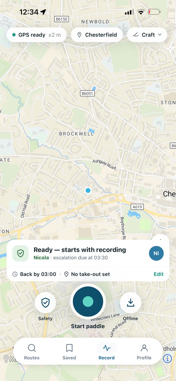
The record screen with a float plan armed: the chosen contact, the expected return time, and when the alert would go out.
Float plans
Tell a contact where you are going and when you will be back. Miss your expected return and they can be notified with the plan and the last position your phone managed to send. It is not a monitored rescue service.
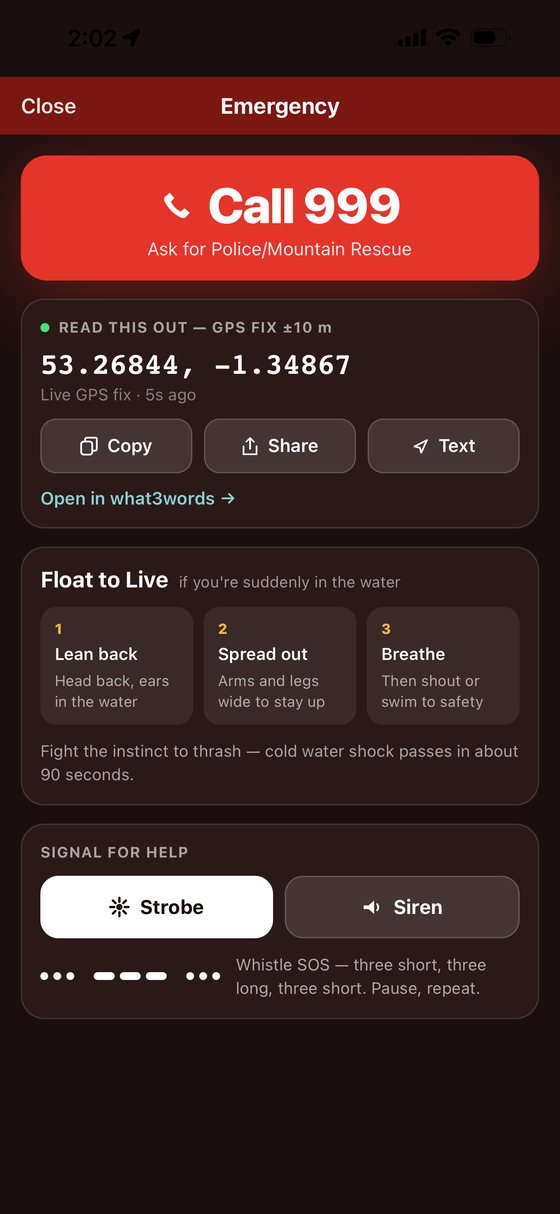
The emergency screen: a large Call 999 button, a live GPS fix with copy, share and text actions, what3words, the three Float to Live steps, and strobe and siren buttons.
Emergency screen
The number to call and what to ask for, your live GPS fix ready to read out or share, what3words, Float to Live, and a strobe and siren to signal with.

Route discovery, recording, saving and core safety tools are currently included free. Pro adds live conditions, offline maps, analytics and more.

Or publish 3 routes and a month of Pro is free →
on the water

Go paddle

The parts that have to work with wet hands, one bar of signal and a phone you would rather leave in the dry bag.
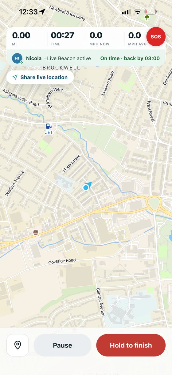
A paddle being recorded: distance, elapsed time and speed across the top, an active Live Beacon and float plan, the live map below, and pause and hold-to-finish controls.
Record every paddle
Distance, time and speed in numbers you can read at arm’s length, with a hold-to-finish control that survives cold hands. Every position is written to your phone as it goes, so a crash or a flat battery doesn’t lose the paddle.
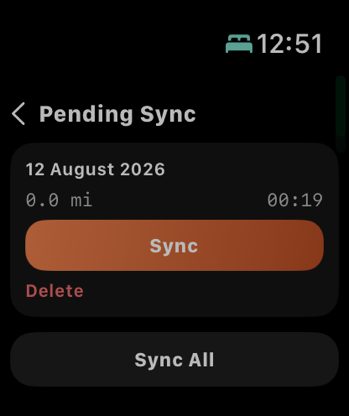
The Apple Watch pending sync list, holding a finished paddle with Sync and Sync All actions.
Or record from your wrist
Start from the Apple Watch and leave the phone in the dry bag. The finished paddle stays on the Watch until your iPhone confirms it has it, then syncs on its own.
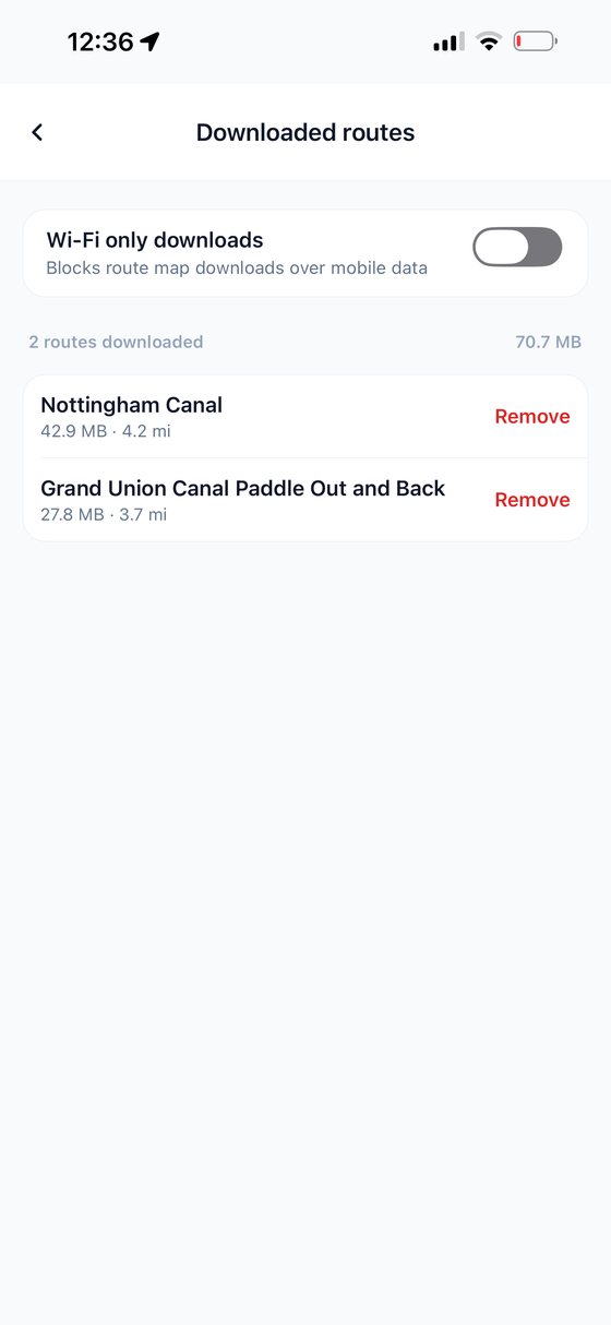
The downloaded routes screen: a Wi-Fi-only download setting, and two saved routes listed with their size on disk.
Prepare before signal disappears
Download the route and its map before you leave. Recording keeps running with no signal and uploads when you are back. Live conditions, Beacon and check-ins still need a connection.
the paddle routes family

Be one of the first to join.

Plan on your phone or in any browser. Real routes, added by paddlers like you.

Open the web app
free to join · the safety tools are free for everyone